
Are drones the right tool to help you measure your pasture?
Practical pasture decisions for farms that need clear, reliable information.
You might have heard about drones and their potential to transform agriculture. But is it the right tool to help you measure your pasture? To answer this, let me tell you how drones work.
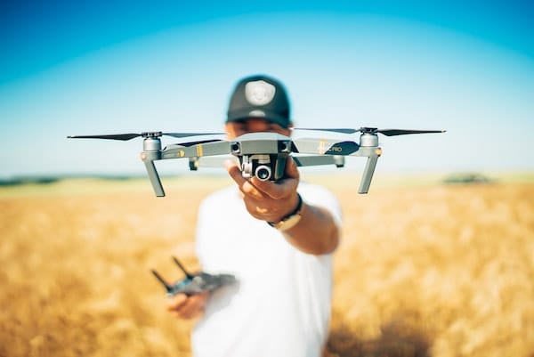
What drones are good at
Today, there are many types of drones in the market built for agriculture. Usually, they are known as UAV (unmanned aerial vehicle) drones for agriculture.
A drone makes use of multispectral images to show differences between healthy and unhealthy plants. Because drones can cover hundreds of hectares, in less than an hour, they have several advantages:
- They eliminate the need for a person to manually scout and assess the farm.
- They can take very high-resolution images that reveal a lot of detail about a crop’s condition.
- They offer an effective way to monitor crops more frequently for critical indices like CCCI (canopy chlorophyll content index), CWSI (crop water stress index), and NDVI (normalized difference vegetation index).
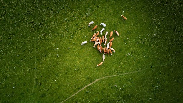
Drones can help identify agricultural issues such as irrigation problems, soil variations, and pest or fungal infestations. Not to accurately measure and monitor pasture growth.
So, are drones the right tool to help livestock farmers like you to measure pasture growth? We don’t think so. Here are three key reasons why a drone may not be the right tool for you:
First, drones are expensive
Today, an agriculture UAV drone costs between 2,000 and 25,000 dollars. This is quite expensive.
In addition to this, you will also need to learn how to fly it. Depending on your choice, of course, expect to shell out another 500 to 8,000 dollars.
You could also consider hiring a professional service provider to do this for you. But, because drones are still nascent, you may not be able to identify a provider near you.
And even if you do, most operators will charge you between 5 and 10 dollars per acre, every time you want to survey your farm. This adds up quickly. And even worse, it might reduce how often you measure your pasture. It might also result in lower farm productivity and unrealized profits.
Second, drones need other supporting technologies. This will further cost you
Drones by themselves are just small aerial vehicles that can carry some light load. To get them to measure and monitor your pasture (or crops), you need additional technology. Such as cameras, sensors, and image processing software.
In case your drone doesn’t come with a good camera, you will have to buy one. Depending on your choice of camera, this will set you back by a further USD 200 for a simple GoPro HD camera up to USD 50,000 for a hyperspectral camera.
Also, depending on how accurately you want to measure and monitor your pasture (or crops), you may need to invest in thermal or LIDAR sensors. These are quite expensive and generally cost more than 5,000 dollars.
But it doesn’t end there. Even after you have all the necessary hardware, you still need to map all the hundreds of pictures with appropriate GPS co-ordinates and stitch them together into a mosaic of images. Only then will you be able to make sense of the photos. To do this, you will need image processing software such as Pix4D or SenseFly. This will again cost you up to 300 dollars a month.
Third, you need to obtain a remote pilot license and comply with regulations
Earlier, to fly drones, you needed to have a COA pilot's license. This is no longer required today. However, you still need to get a remote pilot certificate with a small UAS rating. This is always a cumbersome process.
Also, in most parts of the developed world, you have to ensure that you comply with several regulations. Regulations such as avoid flying near aircrafts or airports, to always fly below 400 feet, to always fly via line-of-sight, to only operate during daylight hours, and to register with the FAA.
These are cumbersome, undesirable, and in most cases, outright irritating for a busy farmer. It may not be a convenient solution for most livestock farmers. This is also probably why there aren’t any drone-based businesses, at least as far as we know who specialize in pasture measurement.
When drones might be right for you
Let us take a step back. We do not doubt that drones are a promising technology for agriculture.
It might be a good fit in case you need to continually monitor the health of valuable crops or fruit tree orchards. In this case, the high-resolution drone images can help you diagnose problems better than most other technologies.
It might also be a good fit if you genuinely enjoy flying a drone and playing around with image processing software to analyze your results.
It may also even help you earn some side income if you foresee doing this as a service for other neighboring farmers.
However if these are not your needs, to measure and monitor pasture alone, drones don’t make sense. At least they don't work as of today. Especially, considering that you have affordable satellite technology-based service providers, such as Pasture.io, who specialize in helping you make effective grazing decisions.
We come to the end of this article. I hope this was useful to you.
At Pasture, we are building a product that puts your pasture growth measurements on autopilot. This allows you to make accurate, grazing decisions, improve farm productivity, and earn more profits. Some of our farmers have received up to a 40x return on their investment by using our service.
Until we meet again, Happy farming!
- The Dedicated Team of Pasture.io, 2020-01-15